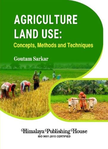
This book covers the crucial different types of agricultural definitions, objectives, place of agricultural geography, scope, factors, newer models concerning agricultural planning, agricultural land use classification, and its change day to day. Various geographers’ agriculture productivity approaches, and their zonation, modern agriculture regionalisation techniques, and mapping are used in agriculture infrastructural practice. The role of markets in the agricultural system, transport, banking, and seed storage in agricultural land use, agriculture farm size, cropping pattern, and trends of agricultural land use with suitable mapping based on Geographical Information System (GIS) & Remote Sensing (RS) and other suitable software. The impacts of agricultural land use on farmers are highlighted on theoretical and practical bases. Every map and diagram is included to provide a lucid and meaningful exposition of the concept. Agricultural land use is a multifaceted subject of study and research on these related issues.
This book serves as a valuable textbook for students and teachers of geography as well as agricultural geography. It will especially benefit three groups of readers: firstly, agricultural geographers who want to find out ‘what are the main issues of agricultural land use change’ by exploring the complex interactions of spatially linked various issues. Secondly, the agricultural practitioner who is interested in ‘why agricultural land use changes over time’ has been presented by GIS & RS platforms through the display of agricultural land use change maps and agricultural crop regionalisation maps. Thirdly, it will also help other branches of geography (economic geography) students, teachers, and researchers mainly those who are not concerned with agricultural land use changes in recent times and economists, agricultural planners, agricultural policy makers, agronomists, agricultural engineers, and those who are eagerly interested in working on this subject.
Contents –
SECTION ONE
(Introduction of Agricultural Geography and its Approaches)
Chapter 1. The Study of Agricultural Geography
1.0 Introduction
1.1 Place of Agricultural Geography
1.2 Definitions of Agriculture Geography
1.3 Objectives of Agricultural Land Use Studies
1.4 Preceding Book and Journal Works
References
Chapter 2. Overview of the Study Area 13-30
2.0 The Study Area
2.1 General Land Use Types
2.2 Secretarial Structure
2.3 The Objective of the Study
2.4 Purpose of the Study
2.5 Methodology
2.5.1 Primary Data
2.5.2 Secondary Sources
2.5.3 Statistical Tool Used
2.6 Hypothesis
2.7 Organisation of the Book
2.8 Software Used
References
SECTION TWO
(Geographical Nature and Factors of Agricultural Land Use)
Chapter 3. Geographical Environment for Agriculture Land Use
3.0 Introduction
3.1 Physiography
3.1.1 Relief
3.1.2 Geohydrology
3.2 Drainage Network
3.2.1 Nature of Mahananda River
3.2.2 Nature of Nagar River
3.2.3 Nature of Gamari River
3.2.4 Nature of Kulik River
3.2.5 Nature of Srimati River
3.3 Major Wetlands
3.3.1 Utility of Wetlands (Local name is bil)
3.4 Climate Physiognomy
3.4.1 Rainfall Characteristics
3.4.1.1 Agro-climatic Region
3.4.2 Temperature
3.5 Soil Condition
3.5.1 Soil Textural Characteristic
3.5.2 Soil Structural Characteristic
3.6 Natural Vegetation
3.6.1 Composition of Forest
3.6.2 Better Development of Forest
3.7 Conclusion
References
Chapter 4. Factors for Changing Agricultural Land Use 61-92
4.0 Introduction
4.1 Factors of Agricultural Land Use Change
4.2 Distribution of Population
4.2.1 The actual Growth of the Population in Uttar Dinajpur District (1961-2011)
4.3 Density of Population (1961-2011)
4.4 Growth of Population
4.5 Decadal Variation of Population in Uttar Dinajpur District (1961-2011)
4.6 Change of Land Ownership
4.7 Expansion of Urban Area (1961-2011)
4.8 Expansion of Irrigation Area (1971-2011)
4.8.1 The Actual Growth of Irrigation Area in Uttar Dinajpur District (1971-2011)
4.8.2 Impact of Irrigation on Agriculture
4.9 Conclusion
References
SECTION THREE
(Agricultural Regionalisation and Productivity Approaches)
Chapter 5. Agricultural Regionalisation and Productivity Approaches 95-133
5.0 Introduction
5.1 Techniques to Delimit Agricultural Regions
5.1.1 Empirical Technique
5.1.2 Single Element Technique
5.1.3 Multi-element or Statistical Technique
5.1.4 Quantitative-cum-Qualitative Technique
5.2 Agricultural Productivity
5.2.1 Different Approaches for the Measurement of Agricultural Productivity
5.2.2 Yang’s crop Yield Index Method of Agricultural Productivity (1965)
5.2.2.1 Agricultural Productivity Region based on Cereal Crops
5.2.2.2 Agricultural Productivity Zone based on Pulse Crops
5.2.2.3 Agricultural Productivity Zone based on Cash Crops Yield Index
5.2.2.4 Agricultural Productivity Zone based on Miscellaneous Crops Yield Index
5.3 Conclusion
References
SECTION FOUR
(Infrastructure Conditions for the Development of Agriculture)
Chapter 6. Infrastructure for Agricultural Practices 137-194
6.0 Introduction
6.1 Modes and Intensity of Irrigation
6.1.1 Tank Irrigation (TI)
6.1.2 River Lift Irrigation (RLI)
6.1.3 Deep Tube Well (DTW)
6.1.4 Shallow Tube Wells (STW)
6.1.5 Canal Irrigation (CI)
6.1.6 Problems and Possibilities of Irrigation
6.2 Agricultural Seed farm
6.2.1 Role of Seed Farm in the District
6.3 Transport facilities
6.3.1 Modes of Agricultural Production from Farm to House
6.4 Market facilities
6.4.1 Infrastructure of the Big Market (hat)
6.4.2 Infrastructure of the Medium Market (hat)
6.4.3 Infrastructure of the Small Market (hat)
6.4.4 Krishak Bazars (KB) as an Agricultural Marketing Place
6.5 Storage facilities
6.5.1 Status of Cold Storage and its Potential in Uttar Dinajpur District
6.5.2 Storage Condition
6.6 Banking system
6.6.1 Involvement of Financial Institution
6.6.2 Period for Loan Sanctioning from the Date of Applications
6.6.3 Opinion of Non-borrower Farmers
6.6.4 Different Sources of Disbursement Loaning Facilities of Cultivators
6.6.5 Pattern of the Loaning System in Agricultural Sectors
6.6.6 Problems of the Agricultural Loan in Uttar Dinajpur District
6.7 Conclusion
References
SECTION FIVE
(Changes in Cropping Pattern, Farm Size, Agricultural Land Use Scenario, Per Capita Income, Level of Education, Yield Rate, Agricultural Unemployment and Land Ownership Change)
Chapter 7. Changes in Agricultural Land Use
7.0 Introduction
7.1 Cropping Pattern
7.1.1 Cropping Seasons
7.1.2 Agricultural Operations
7.2 Trends in Area Under Major Crops
7.2.1 Paddy Area
7.2.2 Wheat Area
7.2.3 Potato Area
7.2.4 Mustard Area
7.2.5 Mashkalai (vigna mungo) Area
7.2.6 Lentil Area
7.2.7 Jute Area
7.2.8 Tea Area
7.2.9 Horticulture Crops Area
7.3 Changes in Production and Productivity
7.3.1 Paddy production and Productivity
7.3.2 Wheat Production and Productivity
7.3.3 Production and Productivity of Potato
7.3.4 Production and Productivity of Mustard
7.3.5 Production and Productivity of Maskalai
7.3.6 Production and Productivity of Lentil
7.3.7 Production and Productivity of Jute
7.3.8 Production and Productivity of Tea
7.4 Farm Size and Cropping Pattern
7.4.1 Difference between Agricultural Land Use and Cropping Pattern
7.5 Cultivated Area
7.6 Net area Sown
7.7 Fallow Lands
7.7.1 Current Fallow
7.7.2 Fallow and other than Current Fallow
7.8 Culturable Waste Land
7.9 Land Under Misc. Tree Crops and Groves
7.10 Permanent Pasture and Other Grazing Lands
7.11 Trend of Changes in Agricultural Land Use
7.12 Conclusion
References
Chapter 8. Impact of Changes in Agricultural Land Use
8.0 Introduction
8.1 Per Capita Income
8.2 Level of Education in the Agricultural Sector
8.3 Change in Yield Rates
8.4 Agricultural Unemployment and Population Growth
8.4.1 Types of Unemployment in Agriculture
8.4.2 Causes of Increase in Agricultural Unemployment in the District
8.5 Land Ownership
8.5.1 Lease Land Taken by the Farmers from the Owners
8.5.2 Lease out Land given by the Owner to the other Farmers
8.6 Conclusion
References
SECTION SIX
(Summary and Conclusion)
Chapter 9. Summary and Conclusion
APPENDICES


